Link to home

Sampling Site Data & Images

Data Search
Search Hints

World index map Asia index map Site location map

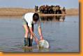
Click on a red dot for sampling site information

  • The map below shows the area of south-central Mongolia traveled during the 2002 Mongolia Expedition of the Natural History Museum of Los Angeles County. Aimag (district) capitals are labeled (names and spellings are from the U.S. NIMA GEOName database).
  • The expedition began in the national capital Ulaanbaatar and continued southeast in a clockwise loop. We have color-coded our trip on the map: mornings begin in pale red and the trail color darkens through each day. Note that in the northwest part of the trip we retraced our route on some occasions.
  • Each red dot is a sampling site. Click on a dot to view data and images from that site and nearby sites.
  • Along the track, all visible bodies of water were sampled. Sections without sampling dots either had no plausible sampling sites or had water contiguous with already-sampled sites.


Comments or questions?
Please contact us

Creative Commons License
All content on this website (including text, photographs, and any other original work), unless otherwise noted, is licensed under a Creative Commons License.

This project supported by grants DEB-BE:0120635 and DEB-PEET:9978193 from the National Science Foundation


National Science Foundation
NHMLAC Logo

Natural History Museum
of Los Angeles County